| the north bank of the yarra (cbd side) is gross: MAY 1853 ‘William Kelly writes that at the time of his arrival in May 1853, ‘The north bank of the Yarra….was a slough of dark mud in a state of liquidity, only a very few degrees removed from that of the river, and along it…was a line of lighters and intercolonial vessels, four deep, discharging promiscuously into the mire bales of soft goods…and a hundred-and-one other and sundry articles, piled up in mountains in the muck…’ SOURCE p123 The Golden Age: A History of the Colony of Victoria 1851-1861 by Geoffrey Serle, 1977 Melbourne University Press. |
SOUTH 1 COLES WHARF aka Queens Wharf
remains of wharf are probably located under Batman Park between Spencer and King Street
SOURCE https://vhd.heritagecouncil.vic.gov.au/places/13854/download-report
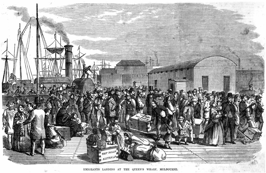
Immigrants arrive with their goods at Queens Wharf, near the Customs House, 1854.
SOURCE
https://museumsvictoria.com.au/immigrationmuseum/resources/customs-house/
Following its official establishment by the Crown in 1837, Melbourne developed into a port town primarily servicing the pastoral industry, the colony’s main source of wealth. Flinders Street became a hub for early industry and trade, particularly given its proximity to the Yarra River. The settlement’s major wharf, Queens Wharf, was built 300 m west of the study area along the banks of the Yarra River in 1841. The wharf was the settlement’s principle point of debarkation and customs control for several years. The privately owned Raleigh’s and Coles’ wharves were also established in the 1840s, directly across from the from the present-day 556−560 Flinders Street (Lewis 1995). SOURCE ‘Preliminary results of excavations at Langlands Iron Foundry and Stooke’s Shipping Butchers, 556−560 Flinders Street, Melbourne
Tom Mallett, Sarah Myers, Sarah Mirams, Felicity Coleman and Fiona Shanahan’ p1 ,2
SOUTH 2 & 3 current day ENTERPRIZE PARK
– Enterprize Park was formerly a deep basin carved out of the river bank by thousands of years of pounding by Freshwater Falls. It is now covered by a deck.
SOURCE Melbourne’s Hidden Waterways: Revealing Williams Creek by Janet McGaw and Cliff Chang, University of Melbourne
https://doubledialogues.com/article/melbournes-hidden-waterways-revealing-williams-creek/
-first European boat to arrive here, the ‘Enterprize’, drawing up to this once-muddy river bank and unloading its foreign cargo of tents, animals and colonists, in 1835.
The ‘Enterprize’ carried John Fawkner’s party, travelling from Van Diemen’s Land. Fawkner had to remain behind and arrived a few months later.
William Lonsdale followed a year after that.
SOURCE: https://aboriginal-map.melbourne.vic.gov.au/146
IMAGE
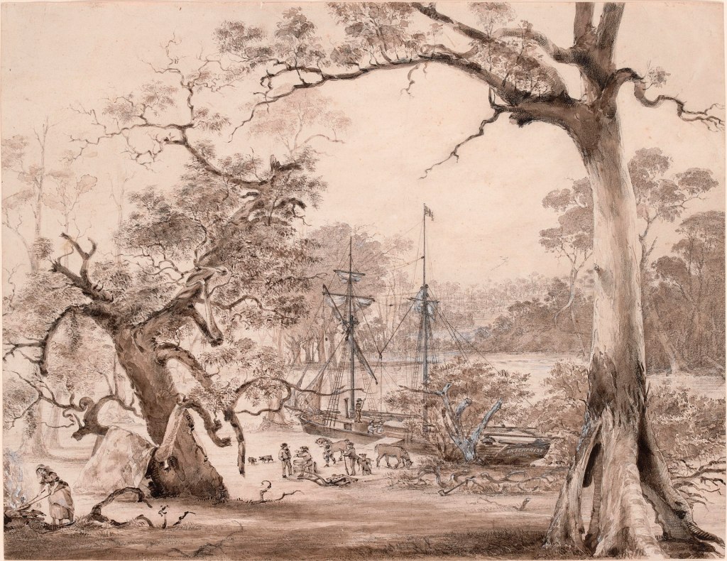
A watercolour painting of the topsail schooner, Enterprize, at the founding of Melbourne in August 1835. The author and date of creation are unknown but a replica was published in Harper’s Weekly (New York) vol. 29, no. 1498; 5 September 1885 p. 580.
https://en.wikipedia.org/wiki/Enterprize_(1830_ship)#/media/File:The_Enterprise_at_the_founding_of_Melbourne,_29_August_1835.jpg
The first Customs officer arrives and sets up the Custom Tent along Yarra BLOCK 59 or SOUTH 3
1836 ‘Governor Bourke in Sydney had to accept the illegal settlement at Port Phillip by John Batman and his fellow entrepreneurs. There was little he could do to prevent it. But Bourke could at least ensure that smuggling was prevented and that customs duties were paid on all goods brought into Melbourne.
The Customs Tent
Robert Webb established his customs house in a round white tent pitched beside the Yarra River, close to where the boats unloaded their stock and supplies.
The customs service immediately paid its way. In (the next year) 1837 Webb collected duties of 3000 from 140 ships, far more than his annual salary of 200.
SOURCE
https://museumsvictoria.com.au
/immigrationmuseum/resources/customs-house/
SOUTH 3 & 4 THE FALLS double check exact location it might be more SOUTH 2/3
SOURCE Melbourne’s Bluestone Story 2021-07-18 by Fiona Anderson https://www.weekendnotes.com
/melbourne-bluestone-story/#:~:text=As%20it
%20is%20an%20
igneous,other%20more%20bland%2C%20greyish%20basalts
////////
The Falls was a natural basalt ridge that ran across the Birrarung (Yarra River), about half a metre above the high tide mark. It was the only crossing point for several kilometres for the Eastern Kulin, and divided the river into two different ecosystems: freshwater above and saltwater below.
It was of great importance to the Eastern Kulin, who camped and met near here to settle grievances and for other matters.
This area was rich in resources with all manner of birds, including pelicans, egrets, black swans, magpie geese and ducks, found along its banks. The river was also rich in fish, including black fish, bream, flounder and herring. Remnants of the Falls can still be seen today by the exposure of a small basalt ridge on either side of the river
SOURCE: https://aboriginal-map.melbourne.vic.gov.au/85
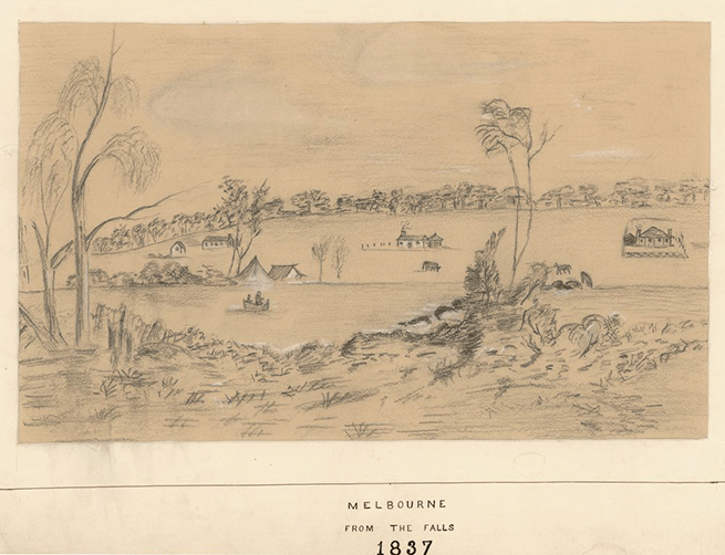
1858 VIEW OF SOUTH 3
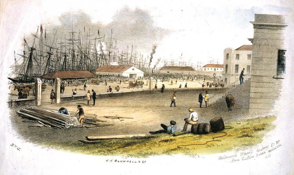
Customs House enclosure, Melbourne, 1858 looking on to SOUTH 3

#/media/File:The_Enterprise_at_the_founding_of_Melbourne,_29_August_1835.jpg)